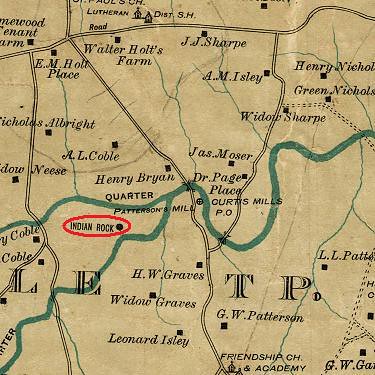
Speaking of curious rock outcroppings on old maps, I have taken note of two on W. L. Spoon's 1893 Map of Alamance County. The first one is "Indian Rock" which is shown in the fork between the North Prong and the South Prong of Stinking Quarter Creek. This site would be a little ways upstream of the Friendship-Patterson Road bridge over Stinking Quarter Creek. Here's a detail from Spoon:

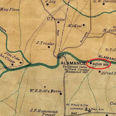
The other spot is Buzzard Rock which is shown on the Spoon Map a little downstream of the village of Alamance on Big Alamance Creek:

I don't know what either of these places are or what the origin of either name is, but it would be interesting to locate these two rock outcroppings today.


One freind emailed me a little while back and mentioned that he "walked all around buzzard rock and Tryon’s camp (little buzzard rock)." I am emailing him to follow up on this.
ReplyDeleteAnother friend says: "Buzzard rock, downstream of Alamance, is a cliff, right on the creek. I've toured it with ex-mayor of town of Alamance and Dr. Sam Powell and Dr. Deborah Amaral, as a potential park site. Dr. Powell had some info on Cornwallis, but I don't know about references . . . you can paddle down Alamance creek (water level is dam controlled and fairly steady) to the first turn, about 1/2 mil in, then when you are done, you just paddle back upstream to the road."
ReplyDelete