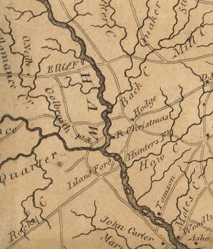
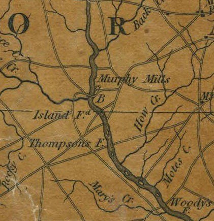
Here are a couple of views of the Island Ford vicinity from old maps:

Collett 1770
Price-Strother 1808
MacRae-Brazier 1833
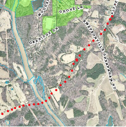
As the Trading Path approached Swepsonville (formerly Armstrong's Mill, Murphey's Mill, Ruffin's Mill etc.) it followed almost exactly the route of NC-119 coming south from Hawfields Church. Old land records paint a detailed picture of the route and it matches the route of NC-119 very closely. As 119 crosses NC-54, there is a fork in the road. The left fork is Alfred Road and it was the road to the Island Ford.
I think the Island Ford was located just south of the islands at the Puryear Mill and that Tom Burke Lane is a remnant of the road leading down to the river. It would be interesting to get the landowners' permission and check out the route of that road in more detail.


Thank you very much for this Swepsonville history lesson. My 5th great grandfather Jonathan Sell (1729-1800) who lived just north of Hillsborough used to take this Trading Path to the Cane Creek Quaker Monthly Meeting House. He later helped found the Wrightsboro Quaker Meeting in Georgia, before moving back to the Muddy Creek Meeting near Kernersville. The Kernersville area is where most my family still reside. However, I coincidentally live in Swepsonville about a quarter mile from the Trading Path ford across the river. Wow!
ReplyDeleteThank you for posting this information. I have not been able to locate the McCulloh deeds for land now in Orange County. Can you tell me where you accessed them. I live a very long way from Raleigh and the NC Archives - if they are there.
ReplyDeleteThank you, Blanche M. Wallace