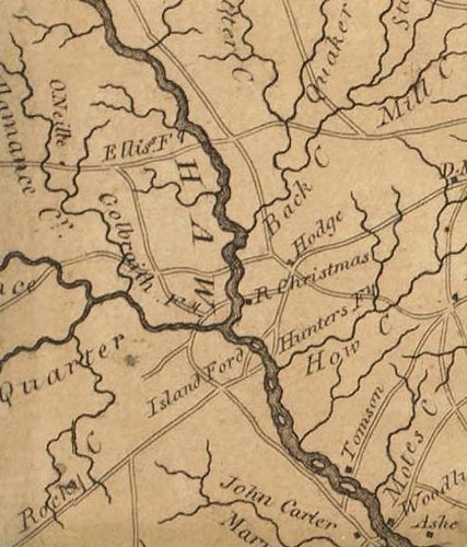
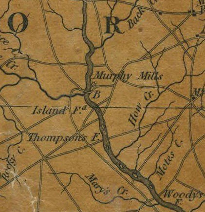
Here are a couple of views of the Island Ford vicinity from old maps:

Collett 1770
Price-Strother 1808
MacRae-Brazier 1833
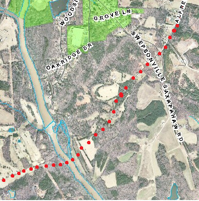
As the Trading Path approached Swepsonville (formerly Armstrong's Mill, Murphey's Mill, Ruffin's Mill etc.) it followed almost exactly the route of NC-119 coming south from Hawfields Church. Old land records paint a detailed picture of the route and it matches the route of NC-119 very closely. As 119 crosses NC-54, there is a fork in the road. The left fork is Alfred Road and it was the road to the Island Ford.
I think the Island Ford was located just south of the islands at the Puryear Mill and that Tom Burke Lane is a remnant of the road leading down to the river. It would be interesting to get the landowners' permission and check out the route of that road in more detail.